fbpx

Thank you!

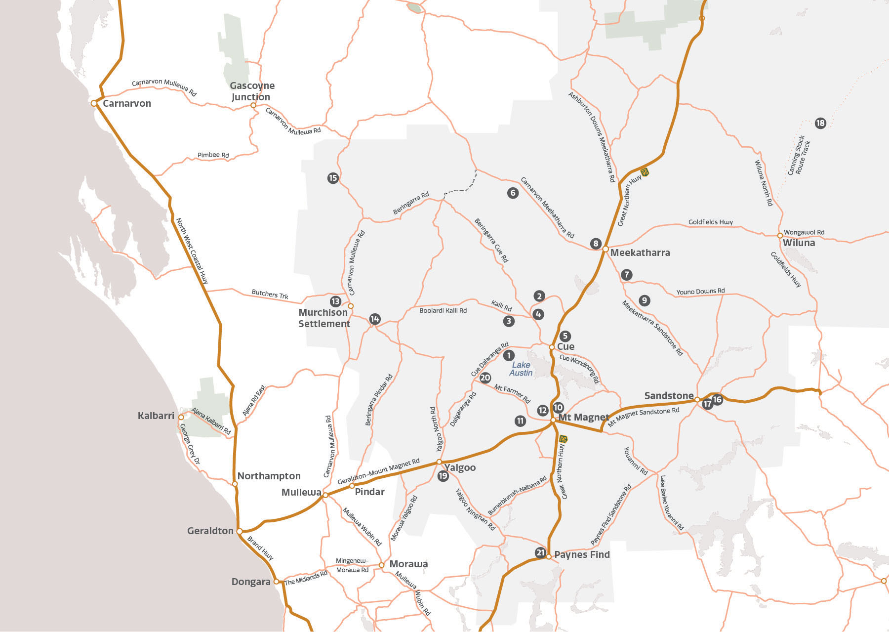
The travel guide is full of information about the geosites and local services to help you plan your trip before you head out. For more information please get in touch with a visitor centre in the region.

We hope to see you in the Murchison GeoRegion soon.

Download our Murchison GeoRegion app for detailed information on the go!

App includes detailed information and location of each site. Available from where you download your apps.

Map of Murchison region of Western Australia

Cue–Dalgaranga Rd, 47km south-west of Cue | Latitude: -27.402960, Longitude: 117.462742

Visits to Wilgie Mia are restricted and cannot be undertaken without permission.

For more information please contact the Cue Visitor Centre.

Via Beringarra – Kalli Rd, approx 70 km north-west of Cue

Visits are by arrangement only. 4WD vehicles are suggested.

For more information please contact the Cue Visitor Centre.

Beringarra-Cue Rd, 36km north-west of Cue | Latitude: -27.130105, Longitude: 117.721615

Cue–Wondinong Rd, 18km south east of Cue | Latitude: -27.488797, Longitude: 118.024509

Jack Hills and Mount Narryer are located on Berringarra–Cue Road.

Access to this site is restricted (for scientific purposes only) due to the need to preserve the outcrops.

For more information please contact the Meekatharra Visitor Centre.

Meekatharra–Sandstone Rd, 40km south-east of Meekatharra | Latitude: -26.904682, Longitude: 118.663404