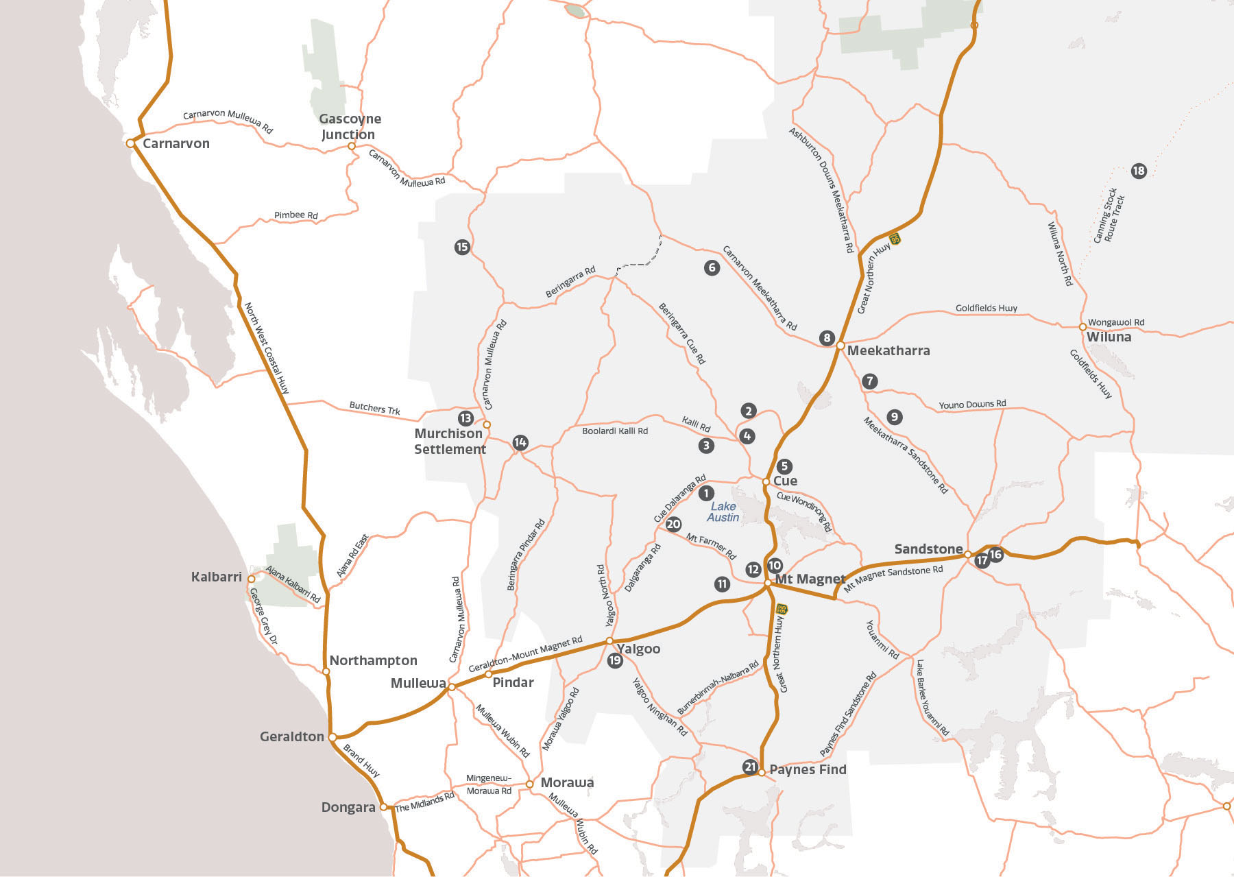
While you are here
Discover the spectacular Murchison GeoRegion
Need more information about what there is to do in the region? Ask a local!
The towns in the Murchison GeoRegion all have unique attractions and things to see and do. Call in to a local Visitor Information Centres to find out more and make sure you set aside some time for star gazing!
The Trail Guide is being updated to better guide you to geosites, some of which are on easily accessible public reserves.
Cue
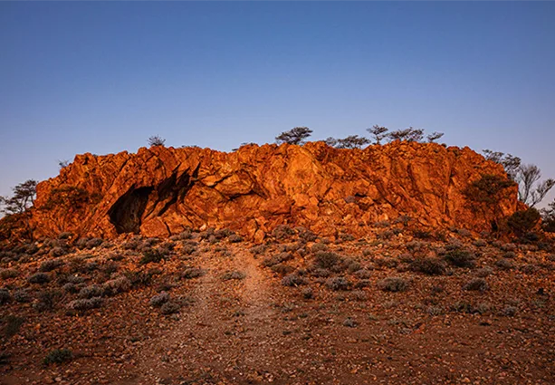
A geological wonderland, ochre was mined at Thuwarri Thaa “the place of red ochre” – Wilgie Mia for millennia and traded across the country – while completing the largest Aboriginal rock art gallery in Western Australia at nearby Walgahna (Walga) Rock, one of Australia’s largest 2.6 billion year old granite monoliths.
Colloquially named ‘Queen of the Murchison” during the 1890’s goldrush, it was after gold was discovered north at Nannine (1890) and south at Mt Magnet (1891) that in 1892, gold was discovered in Cue – a perfect location for the vital civil administration Warden’s Court to be located for the rising Murchison Goldfield, albeit at first in a tent!
With a population increasing to near 10,000 with nearby Day Dawn and famous Great Fingall Mine prosperous – weathered granite blocks were cut to build gracious public buildings, where Cue Heritage Discovery Centre is now open.
Connect with Cue Heritage Trail to discover more, like 1895 two storied Gentleman’s Club with rock face facades made from squared coarse granite and varied rougher stonework, which has connection to 31st U.S. President Herbert Hoover – then consultant mining engineer. His wife was the first woman in that country to obtain a geology degree. Now restored and accommodating the Shire offices and historic photographic collection, the Murchison region’s unique Cue Parliament is also held here.
Meekatharra
Meekatharra is a golden prospect for visitors to the Murchison GeoRegion, with the gold mining riches of yesteryear leaving a rich legacy for the town and the region. Explore the rocky outcrops, look for native animals and experience the glorious display of colourful wildflowers which bring Meekatharra to life in winter and spring.
Originally a gold prospecting town first settled in 1896, the area around Meekatharra is rich in history and culture. Take some time to explore the Meeka Discovery Trail which winds around the town and includes a lookout where you can see a ‘superpit’ mine and the township.
Open on weekdays, the Meekatharra Museum contains over 100 photographs and memorabilia of life through the years.
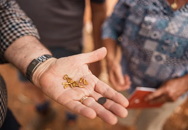
Explore the Meeka Heritage Trail and State Battery, discover some local art or call into the Visitor Centre to find out where you can search for your next gold find!

Mount Magnet
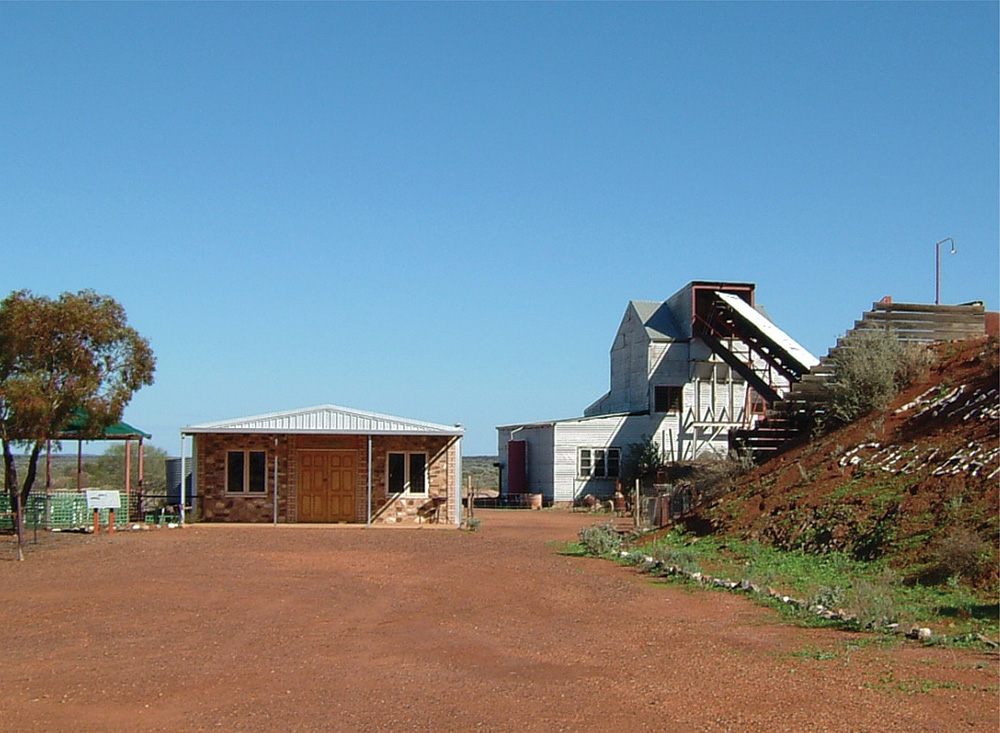
Mount Magnet is oldest (since 1891) continuous gold mining centre in Western Australia, with ancient geological and rich cultural history at the heart of its story. Destination Visitor Centre displaying Sciart Genestream Songlines Mural and “Ron the Rockman – Treasures of the Earth Collection”, is located at southern entrance to town – opening into famed regional Mining and Pastoral Museum. Immerse yourself here, where you can also see the rebuilt Boogardie State Battery and outstanding Rabbit Proof Fence story, large engines and film set exhibits.
Heritage Walk is a leisurely stroll through town. Wide roads, goldrush shop and hotel fronts, outdoor picture theatre, shady Barimaia Creek where gold first sluiced and parks invoke a feeling of days gone by. You’ll pass 1898 shire admin building and 1896/8 School Master’s House made of local bricks. Alongside, restored “Old School” with newly revealed 2.7 billion year quartz rich sandstone façade, the patches of all types of iron oxides and hydroxides giving the stonework its various colours. Opposite, original “St George Mine” red sandstone Post Office, which operated for 100 years from 1897.
The grand stone Railway Station now gone, public art instead depicts what was once this vital transport hub of town. Decomposing granite passenger and freight train platforms still visible and stone railway houses mark the north south route of historic Mullewa – Murchison Railway through town. Community Reconciliation Wall Mural alongside the Police Station offers a glimpse into the cultural fabric of Mount Magnet – the acknowledgement plaque set on a plinth of Boogardie Orbicular Granite.
Wirnda Barna Art Centre showcases artworks depicting the rich landscape, night sky stories and important cultural sites by Aboriginal artists from Mount Magnet and surrounding region. Badimia Land Aboriginal Corporation also manage The Granites geosite.
Murchison
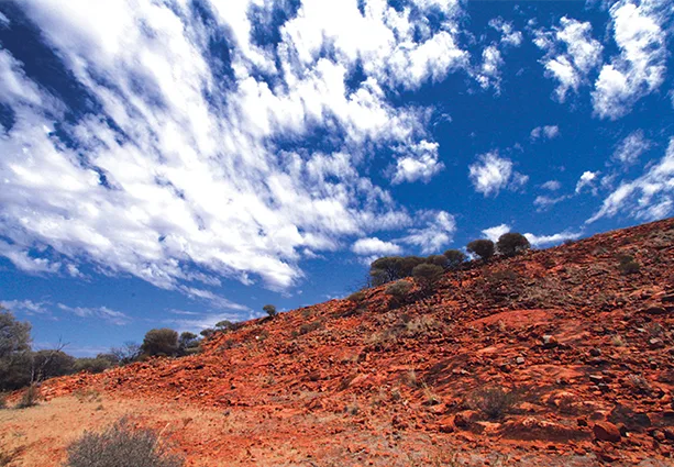
Australia’s only Shire without a town – their tagline, ‘Ancient Land Under Brilliant Skies’ captures the essence of the Murchison perfectly. It is home to sprawling pastoral stations, spectacular wildflower displays, rugged breakaways and cool river pools. Also, the Murchison Radio Observatory is the Australian home of the international science project, the Square Kilometre Array.
Turning gaze from skywards and beginning of the universe, to the ancient land below – Narryer Terrane is located here, where the oldest geological complex of the Murchison GeoRegion – and indeed the world, is formed. Not only neighbouring Jack Hills and oldest terrestrial material, the terrane includes Mount Narryer, a 3.3 billion year old rocky outcrop with detrital zircon grains 4.2 – 4.3 billion years, relics of the earliest formation of the earth’s crust. Mount Narryer is visible as a landmark from the Carnarvon – Mullewa Road but not accessible, being on private property.
The cooler months are the perfect time to explore the rangeland Botanical Walk, go bird watching, take in the amazing night sky or enjoy a barbecue picnic at the restored stock well 55kms south of the Settlement.
Visit the Murchison Museum, constructed from rammed earth in the mid-1980s. The museum collects, preserves, and houses a fascinating display of historical items, as well as an herbarium of rangeland plant species.
If you’re lucky enough to time your visit with the annual polocrosse event, you’re in for a treat with clubs travelling from across the state to attend. Murchison Camp Oven Muster held the first weekend in August is a popular ticketed event featuring outback hospitality, camp oven cooking and bush entertainment including three nights of camping. For more information see Shire of Murchison Events page.

Paynes Find
Located in the Shire of Yalgoo – by the time you reach Paynes Find (Goodingnow), most southerly settlement of Murchison GeoRegion – you have already travelled across part of Murchison GeoRegion’s deeply weathered semi arid landscapes, filled with stories and fascinating geology. Nestled between ancient Banded Iron Formation (BIF) ridges and quartz veins – gold and other minerals are found here in industrial quantities. An occasional inselberg, granite island mountain resistant to weathering, rises through a surrounding treasury of geological features and gems in rust red, sun bleached and “texture contrasted” soils hosting unique and diverse plants and animals.
First pegged by prospector Thomas Payne early last century – in Yilgarn Craton’s Greenstone Belt, metamorphosed volcanic and sedimentary rocks – gold is still mined here. Aboriginal place name Goodingnow (meaning small bird and mallee fowl) – Paynes Find is an essential fuel, refreshment and accommodation stop on Great Northern Highway. Oversized trucks servicing the north, unable to travel at night – pull into the large parking area, perfect for truck spotting! Authentic heritage buildings tucked out of sight can be seen on a drive past the roadhouse to view the original State Battery.
Karara Rangelands Park – exploreparks.dbca.wa.gov.au sharing management with Badimia and Yamatji Traditional Owners, can also be accessed from Paynes Find for accommodation, natural heritage and cultural engagement.
Sandstone
Sandstone is a brilliant location for stargazing and spectacular sunsets. Now a centre for the region’s mining and pastoral industries, the wide streets and historic buildings of Sandstone are a reminder of its heyday following a major gold discovery in 1894.
Built in the 1940s, The Sandstone Heritage Museum was once a grocery store but now houses a collection of photographs and items portraying life in Sandstone at the turn of the 20th century. A short walk from the Museum is The Heritage Cottage built in 1923 by a local pastoralist and furnished to reflect that era.
Pick up a brochure for the Sandstone Heritage Trail and explore the township’s heritage buildings, several of which have been restored, including the Post and Telegraph Office, Warden’s Court and Black Range Chapel.
Play a round on the 18-hole golf course (clubs are available for hire from the Visitor Centre), cool off at the Water Park or try your luck gold prospecting before a sunset picnic.


Wiluna
While Wiluna is no longer within the boundary of the Murchison GeoRegion, now designated to the Goldfields – Esperance region, its geological region is fascinating. The historical connection is with East Murchison Goldfields and as the last town connected to the Mullewa – Murchison Railway Line.
Sitting on the edge of the Western Desert, Wiluna is the gateway to the Canning Stock Route and the Gunbarrel Highway.
The best way to explore the heritage of Wiluna is to follow the Town Heritage Trail which takes you on a fascinating journey to 30 places of interest, with many stories about local characters that once lived there.
Visit the Tjurkurba Art Gallery, for an opportunity to meet and chat with local Aboriginal artists and view original artworks which embody a rich culture of country, history and lifestyle.
Learn the story of Australia’s last desert nomads, Warri and Yatungka who lead a traditional lifestyle in the Gibson Desert until 1977. A statue at the town’s entrance commemorates their life.
Drop into the Discovery Centre, located in the old Wiluna Hospital to learn about more about the fascinating history of Wiluna, the Canning Stock Route and Gunbarrel Highway.
Yalgoo
Yalgoo geology is impressive, causing the area to have its own goldfields before other minerals, gemstones and geological features discovered. Rich in history, the first pastoral leases in the region were taken up here in 1864. Court House Museum holds reminders of these and wild gold rush days. It is the first town on the now abandoned Mullewa Murchison Railway, a grand line still visible from the main road, which serviced the mining and pastoral communities for eight decades.
Yalgoo Heritage Trail connects to a colourful present including Aboriginal art gallery and a fascinating past. Intersected by architect Priest Monsignor Hawes Heritage Trail, where little world treasure St Hyacinth Chapel was built for the Dominican Sisters from mainly Banded Iron Formation. BIF is known as “chemical fossils” marking Earth’s Great Oxidation Event.
Stand on Lookout Hill and observe ancient volcanic activity which formed the Yalgoo – Singleton Greenstone Belt 2.8 – 3 billion years ago. While now seen as rocky outcrops, these were once massive underwater lava plains which were transformed by intense heat, pressure and tectonic shifting forming the metamorphosed basalt lava flows, ultramafic rocks and banded iron formations (BIF).
Karara Rangeland Park (Explore Parks WA) spans through the Shire of Yalgoo.