About the Murchison GeoRegion
The ABC of the Murchison GeoRegion
The Murchison GeoRegion highlights the landscape (abiotic), fauna and flora (biotic), and human (cultural) elements of the region.
The A – B – C encourages us to have a deeper understanding of, and connection with the land we are on.
What is the ABC?
Abiotic or non-living elements refer to the climate and landforms we experience and see, as well as the geological formations and processes that have created what you see around you.
Ancient landscapes, meteorite craters, remnant volcanos and seasonal lakes.
Biotic or living elements refer to the unique flora (plants) and fauna (animals) found in the places we live in and visit, and the unique features that enable them to thrive.
Unique flora and fauna.
Cultural or human elements come from places with abiotic and biotic features or what drew people to the place, and describes how people have engaged with the natural environment in both the past and present.
Oldest living Aboriginal culture, ochre mine and rock art, pastoralism (from 1865) and gold mining (from 1887) .
When you’re exploring the sites in the Murchison GeoRegion stop for a moment to consider this:
The geology or landscape you can see has rocks that are more than 2.5 billion years old.
The land you are standing on ….
- has evidence of all of the continental landmasses throughout the Earth’s history – Rodinia, Gondwana and Pangea
- spans all of the geological timescales – Archaean, Proterozoic and Phanerozoic
- goes back almost to a time when continents as we know them had not yet formed
- has evidence of being home to humans for thousands of years
Find out more about the Murchison GeoRegion geosites here:
Geological Evolution
Deep time in the Murchison region, Western Australia – a virtual tour exploring the geological evolution of the Murchison region between 3.7 and 2.5 billion years ago.
Hosted by Geological Survey of Western Australia, the tour connects the origins of the landscape to sites of significance for local Aboriginal people, and historical gold exploration days of the late 19th and early 20th centuries.
Take a dive into the Argis Storymap Deep time in the Murchison region, Western Australia.
Discover an ancient land from the ground up
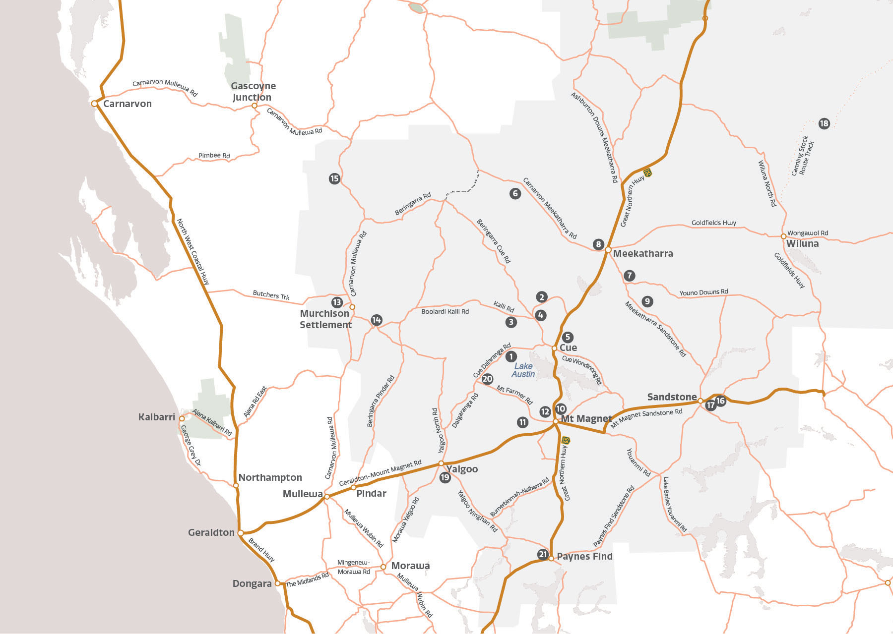
The Murchison GeoRegion self-drive trail takes you on a journey through a unique and ancient landscape full of stories that reach back almost to the Earth’s beginning and visits sites of national and international, natural and cultural significance.
Witness the effect on the land of the massive geological forces of colliding continents, long-gone oceans and destructive meteorites.
Discover the unique native flora and fauna of the Mulga Shrublands. Spot an array of birdlife, track emus, kangaroos and reptiles, and be treated to the dazzling annual display of wildflowers most years, from July to September.
Connect with culture, stories and legends that map thousands of years of human history.
Learn about Western Australia’s largest gallery of Aboriginal rock art, the world’s oldest underground mining operation, see WA’s only remaining gold battery in action, and explore the remains of a fine brewery.


